Tag: utah hiking

  • Hiking to Scout Cave in Snow Canyon near Saint George, Utah

    Hiking to Scout Cave in Snow Canyon near Saint George, Utah

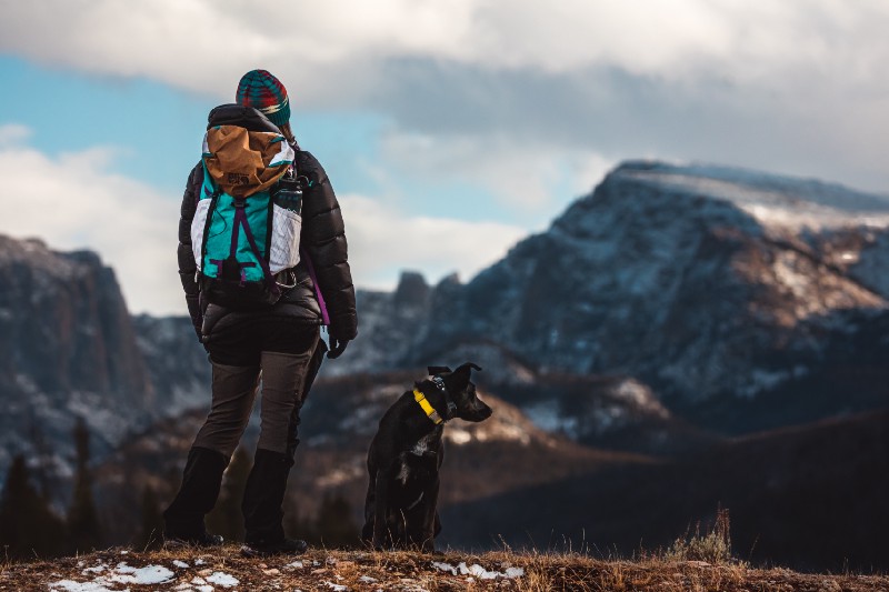
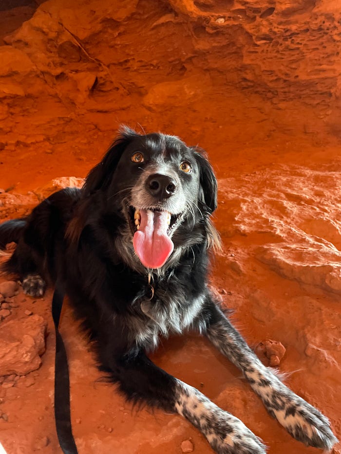
    Hiking up to Scout Cave is a simple and short activity to add to your must-visit category in Saint George, Utah. In this article, I’ll sum up where you can find it and some tips and tricks to help you have a good time and stay safe. Scout Cave is dog friendly, unlike many hikes in the area, so we’ll talk about furry friends too.

    Difficulty

    Before you drive up to Snow Canyon, let’s talk about difficulty. If you are an experienced hiker and climber, Scout Cave will not give you any trouble. However, if you have any health problems or issues climbing a little, you should consult a doctor first. The same goes for your dog. Dogs that can’t climb will need to be carried up a few brief slopes. My border collie had no problem climbing on his own with a little guidance.

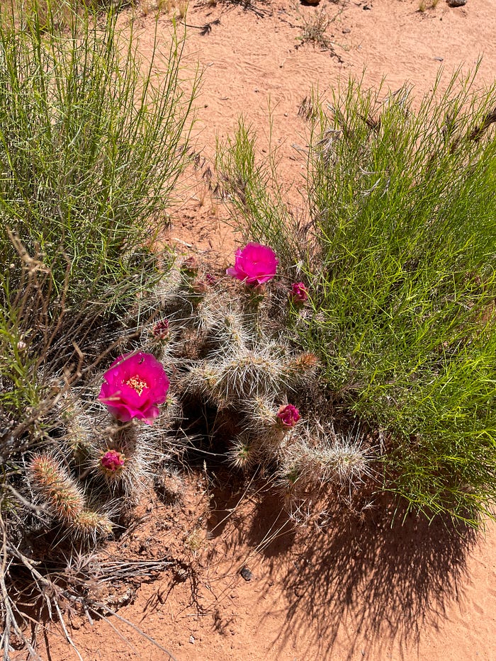
    Children outside of strollers can hike this trail without a problem, but should be closely monitored and assisted by adults. There are a lot of poky plants around and some insects. In the springtime, I got stung by a bee in the cave.

    Photo by Daniel Bradley

    Heat and Time of Day

    Scout Cave is best attempted in the morning or evening outside of the full blast of the afternoon sun. Dogs with thick fur coats should be watched closely and given plenty of water, as well as their humans. The heat can sneak up on you. It may feel moderate at 9 am and then by 10 or 11 you’re sweating buckets. Try to make it just after sunrise if you can. If you do leave later, it’s best if you leave your dog at home and bring lots and lots of water.

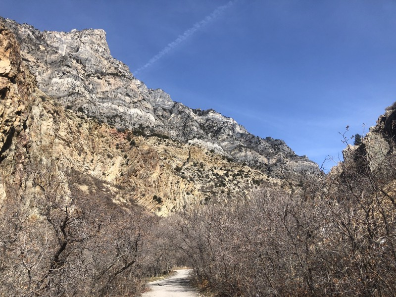
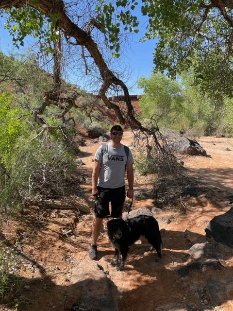
    This hike is almost completely without shade except for some trees near the bottom before you reach the stairs.

    Photo by Daniel Bradley

    Length

    Scout Cave is just under 3.6 miles round trip. Apart from a steep climb up some stairs and a few rocks to climb over, the trail is relatively flat and easy going. The terrain is rocks and sand and should be a little cooler for your pups paws than asphalt.

    Photo by Daniel Bradley

    Driving Directions

    Take exit 6 on I-15 onto Bluff Street and turn north toward Pine Valley Mountain. Continue for about 3 and a half miles. Turn left onto Snow Canyon Parkway and keep going for about 4 miles. On Snow Canyon Dr, turn right and continue 1 mile. You will see a Trailhead on your right across the street from where you can park.

    The Trail in a Nutshell

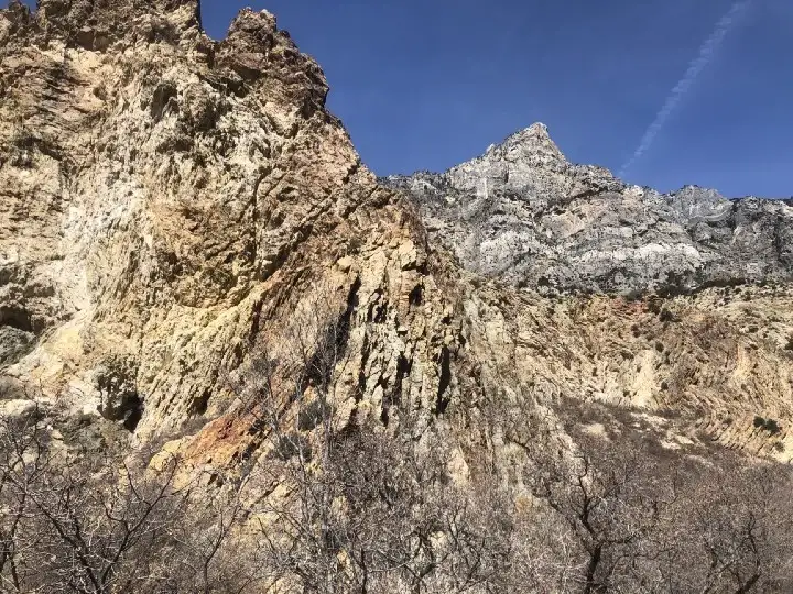
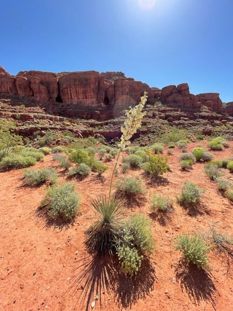
    The trail is straightforward enough. Cross the street from the parking lot and you’ll see the trailhead. Head toward the mountains in front of you. You’ll pass old lava flows and beautiful desert plant life. Eventually you’ll hit an intersection with the Johnson Canyon Trail. Turn right, following the Scout Cave trail and keep going to where the trail passes under some private housing. Follow the trail down to the area at the bottom with trees and sand.

    Photo by Daniel Bradley

    Make sure you’re drinking lots of water.

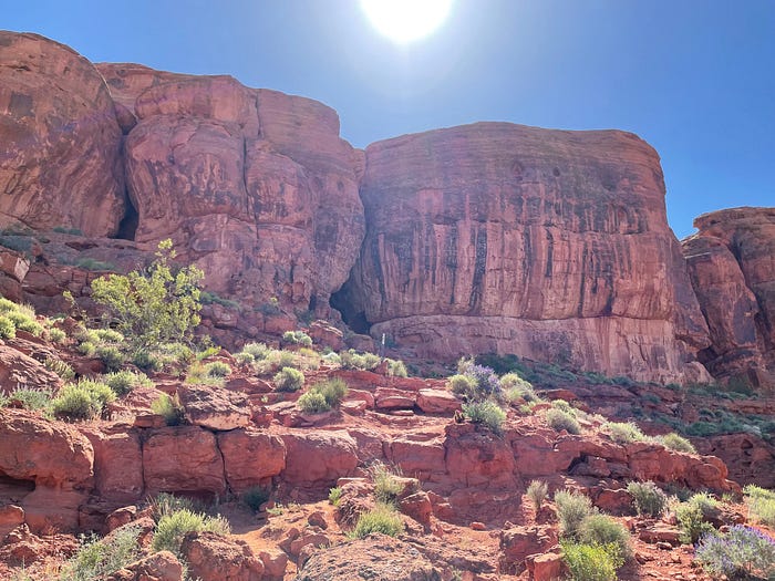
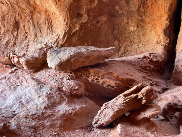
    The trail will head back uphill at some stairs. Take your time and be sure to not fall into any cacti. The trail will seem to end, but if you noticed, you’re on your way to the cave. Climb up the rocks and you’ll see that the trail continues upward. After the stairs, be sure to not turn right. There is an illegal trail heading into the canyon and that is not where you want to go.

    Photo by Daniel Bradley

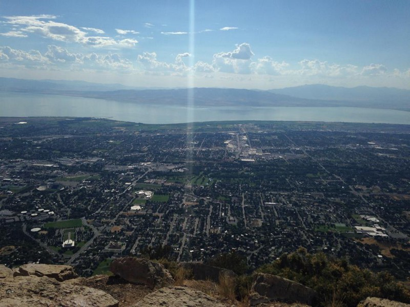
    Climb on up into the cave and enjoy the view!

    Also as I mentioned before, try not to get stung by any bees. My arm was swollen for two days.

    Photo by Daniel Bradley
    Photo by Daniel Bradley

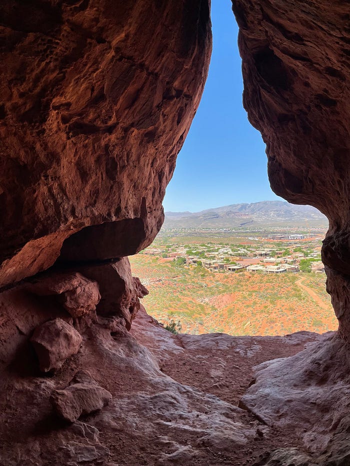
    The cave overlooks the valley below.

    Thanks for reading! If you enjoyed this article, find this one and more at:

    dbradleyexplores.com

    and my Youtube channel:

    https://www.youtube.com/@dbradleyexplores

  • When It’s Okay to Take Your Dog Hiking Without a Leash

    When It’s Okay to Take Your Dog Hiking Without a Leash

    You’re out in the middle of nowhere on a beautiful trail into hills of paradise and you decide it’s time. You lean down, your dog smiles up at you. You take off the leash. Your pooch leaps up in delight and runs circles around you, smelling every bush and loving its little life. I love that feeling. My dog and I experience this all the time.

    So, is it okay to hike with my dog off-leash? It’s a very common internet question. Sometimes, although we don’t want it to be, the answer is no. Let’s talk about when it’s fine to explore without a leash, and when it’s best to keep it on. You have to think about your dog’s training, personality, and the risks and rules of the trail.

    Your Dog’s Behavior

    The longer you’re around dogs, the more you realize that each animal is unique. The first thing you should consider when thinking about taking the leash off on a hike is how well your pup is capable of listening to you. Don’t consider the breed, consider your actual dog, its personality and training.

    What kind of personality does it have? Is it friendly? Independent? If the dog will make you chase it to get the leash back on or bother other people and animals on the trail, its best if you keep your little friend tethered to your person. That way, you can best control your dog in any situation you may encounter.

    Photo by Zdeněk Macháček on Unsplash

    The wilderness is an unpredictable place. Let me tell you a story.

    One time my dog Arthur and I were hiking up Maple Canyon in Utah. Not even a mile from the campground, a large cat came out of the bushes about thirty feet or so in front of us, some kind of lynx or bobcat that was the same size as Arthur. At first I thought it was a cougar. Before I could call Arthur back, he shot after the cat like it was his new best friend and the two of them tore into the bushes. I was freaked out, but I firmly and calmly called to my dog to come back. He did, happy and unhurt.

    I was glad in that moment that I trained my dog to come back when called, or that situation could have escalated into something that I really don’t want to think about.

    Keep your dog trained for off-leash activities and you should be fine, but don’t forget that there are always risks.

    Risks of the Trail

    We’ve started to cover wildlife by talking about my lynx story. Out on the trail, you and your pup can find all kinds of animals. Many of these can view your dog as a threat. Rabies is another thing to think about. If you feel the wildlife risk is too much, what should you use?

    The leash! You have a leash. There’s nothing wrong with keeping it on.

    Another risk to consider is the terrain of the trail. You and your dog have different capabilities when it comes to climbing up and down rocks or walking next to cliffs. You’ll have to be the judge.

    Photo by photo nic on Unsplash

    Another story.

    One time Arthur ran past me really fast next to a very steep hill, one of those that’s practically a cliff. He didn’t mean to, but he ran into the back of my leg while I was standing on loose dirt and gravel and knocked me off the side. Luckily, I was able to stop myself a short ways down and climb back up, but not without a scare.

    These days, I make sure he’s always in front of me on steep hills. If the trail is too risky we go back to the leash life. That way, he still enjoys the hike and I don’t get knocked into a bottom slide toward oblivion.

    Rules of the Trail and Good Manners

    Contrary to what you may want, you and your dog aren’t alone on the trail. There are hikes close to me that I love where the way is often too crowded. I have to think about other users of the trail when I think about taking Arthur off his leash.

    You see, not everyone likes dogs. They might be afraid or they might have allergies. If the trail is too crowded, you should leash your dog. It’s good manners. Going back to behavior, no one wants the liability of their dog knocking over some poor person they decided to jump on or scaring a cyclist into a tree. Those are just some examples of what could go wrong.

    The internet is a great tool to find out the rules of almost any trail. I’ve found close to my house that if a trail is through a National Forest or Bureau of Land Management or something similar, leashes are required in campgrounds or parking lots but dogs can be released once out of those areas. You should check each trail online before you go and follow any posted signs along the way just to be safe. Safe is cool.

    Summed Up

    Off-leash hiking can be a wonderful experience for you and your dog. However, you should consider the precautions I’ve listed in this article before taking the big step of letting your dog roam free.

    1. Is the dog’s behavior suited for the activity?
    2. Is the trail good for free roaming dogs? (Minimal wildlife encounters, good terrain, etc.)
    3. Are you following the official rules of the trail and considering other people?

    If you can answer yes to those three questions, you’re in for some good fun with your best friend. Just make sure you stay alert and responsible. Happy hiking!

    Photo by Chewy on Unsplash

    If you like articles like this, buy this book! It can help you train any dog and learn the in’s and out’s of dog ownership without getting too complicated.

  • Hiking Squaw Peak in Provo, Utah 2023

    Hiking Squaw Peak in Provo, Utah 2023

    This article is for those curious about the climb up to the gorgeous, rocky peak on the north side of Rock Canyon. This day hike takes you up to just under 8,000 feet where you can see all around Utah Valley. If this is your first time climbing a mountain, you’ve chosen the right spot.

    Most healthy individuals can make it up this intermediate hike with the right preparation. If this is one of your first hikes in the area, consider something shorter to get used to the elevation and get in the right shape. A couple of good suggestions would be Y-Mountain and Stewart Falls. Once hikes like those are easier for you, a day trip up Squaw Peak should be fine, unless advised against by a doctor. You should pay attention to your doctor and your body. Common sense, right?

    Now, while I’m aware the traditional name of the peak can and has sparked controversy, I’ve left the title of “Squaw” until local leadership comes up with a better name that people will call it in the future. I’m all about change.

    Now, the details you’re looking for.

    Location

    The canyon itself is located east of the Provo Temple (LDS), which is probably the easiest landmark to spot. From the freeway, you can take the University Parkway exit and travel east up the road several miles until it ends next to the Provo LDS Missionary Training Center. From there, turn left on 900 east and then a right up to the north side of the temple where you’ll hit a curve in the road that looks like a weird intersection above 2300 North and 1450 East. The entrance to the canyon is on the east side of that intersection. There will be parking by a pavilion to the south and all the way up to the trailhead.

    The Rock Canyon Portion

    The trail up Rock Canyon starts out paved and then forks after a few hundred feet, one side still paved and the other side graveled. Pick a fork and keep heading east up the canyon. The two forks will combine again. After .4 miles or so, the trail becomes rocky and you’ll pass through Kitchen Gate next to a popular climbing wall called the Kitchen. Watch for falling climbers.

    As you head up this road, you might notice water to your left if spring runoff is happening and the drought is over. Hopefully soon!

    The next thing to look for is an ever-running water fountain that my friends and I affectionately call the fountain of youth. Be warned, however. Wasps love the fountain more than people do. Rumor has it they’re immortal as long as they drink from the water.

    Follow the hopefully-not-dry creek as you climb the trail for the next mile. You’ll cross the creek five times over some convenient foot bridges. After the fifth, keep your eye out for the fork. It will be the first on your left, somehow marked by the forest service, and there’s a rock where someone etched in a sign pointing the way up to good ‘ol Squaw Peak.

    The Ascent

    The Meadows by Daniel Bradley

    First thing to keep in mind in this next part is that there are no switchbacks. The trail climbs and then keeps climbing, giving you no real bearing on distance. A natural prankster, on my way back down the mountain, I love telling people in this part that they’re getting close. Don’t be like me…but it is hilarious. You’re in for about 1,000 feet of leg-burn on a nicely worn trail. You should be fine, just tell your thighs and glutes that they needed the exercise. Also, by 1,000 feet I mean elevation, not distance.

    One trick, when you’re out of breath, is to tell the group you want a picture. Try not to sit too much. Sitting makes the trip longer and it relaxes your muscles in a way that can make the climbing hurt more when you start up again. But as always, listen to your body. You’ll finish this part at over 7,000 feet.

    You may see deer, cats, squirrels, and other wildlife in this part of the trail, but I wouldn’t get my hopes up. Squaw Peak is a very popular hike and lots of people making noise scares away the animals. However, that also helps keep the bears and mountain lions away. I doubt you were hiking to see those.

    A Break and then One More Climb

    For those hiking for the pictures, save battery and film for the meadows. You’ll find yourself climbing into a beautiful stretch of aspens, wildflowers, and grass with a thin trail guiding you though. Before this part, you’ve been climbing up the back of the mountain, this part is where you will circle around and start seeing little hints of the valley through the trees.

    Photo Cred: Daniel Bradley

    Success! The Peak

    Squaw Peak is the perfect challenge, which makes it so popular. After the meadows and gratefully-rested thighs, the climb starts again one last time. You’ll probably hate it, as beautiful as it is, because you felt like you were almost there. Push through, it won’t be any harder than before. The last hill was worse and much much longer.

    The peak will come upon you suddenly. Oak cover will turn into junipers and the trail will flatten out. Suddenly, the valley will open up in front of you like this:

    (Warning: Spoilers)

    Photo Cred: Daniel Bradley

    That’s the Provo Temple at the bottom left and Utah Lake behind at the top. On peaks like these you can see why people call the area the Great Basin. You’ll see mountains all around you, above and below, with Provo, Orem, Springville, etc. beneath your feet.

    For the inexperienced, a summit like this can be life changing. For the experienced, it’s a recharge, because nothing else compares.

    While you’re admiring the valley, don’t forget to look around at these views, which are great in any season:

    Looking South: Daniel Bradley
    North Toward Timpanogos: Daniel Bradley

    My last suggestion before you follow all this in reverse and make it down in half the time it took you to get up, would be to take a nap at the top. You deserve it.

    Daniel at the Top of Squaw Peak

    Additional Reading:

    Witt, Greg. 60 Hikes within 60 Miles: Salt Lake City Including Ogden, Provo, and the Uintas. Birmingham, AL: Menasha Ridge Press, 2019.

    This book helped me verify a few details and I even learned some. I recommend it for anyone looking for good hikes in Northern Utah.

    Have you ever made this hike? What other hikes in Utah would you like to learn about? Answer in the comments and I’ll do my best to photograph and document your requests.